The Five Questions, the Invisible That Shapes Them, and a New Tool.
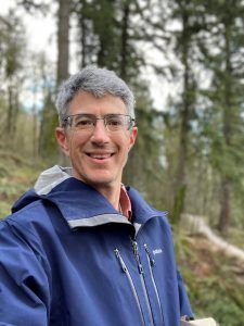
Written by Dave Wagner
"The outstanding scientific discovery of the twentieth century is not television, or radio, but rather the complexity of the land organism. Only those who know the most about it can appreciate how little is known about it." — Aldo
Leopold, A Sand County Almanac, with Essays on Conservation from Round River (1966)
Leopold names the problem before we do. The defining fact of our discipline is not any single technique but the sheer complexity of the thing being managed—a complexity so deep that expertise mostly teaches you the size of your own ignorance.
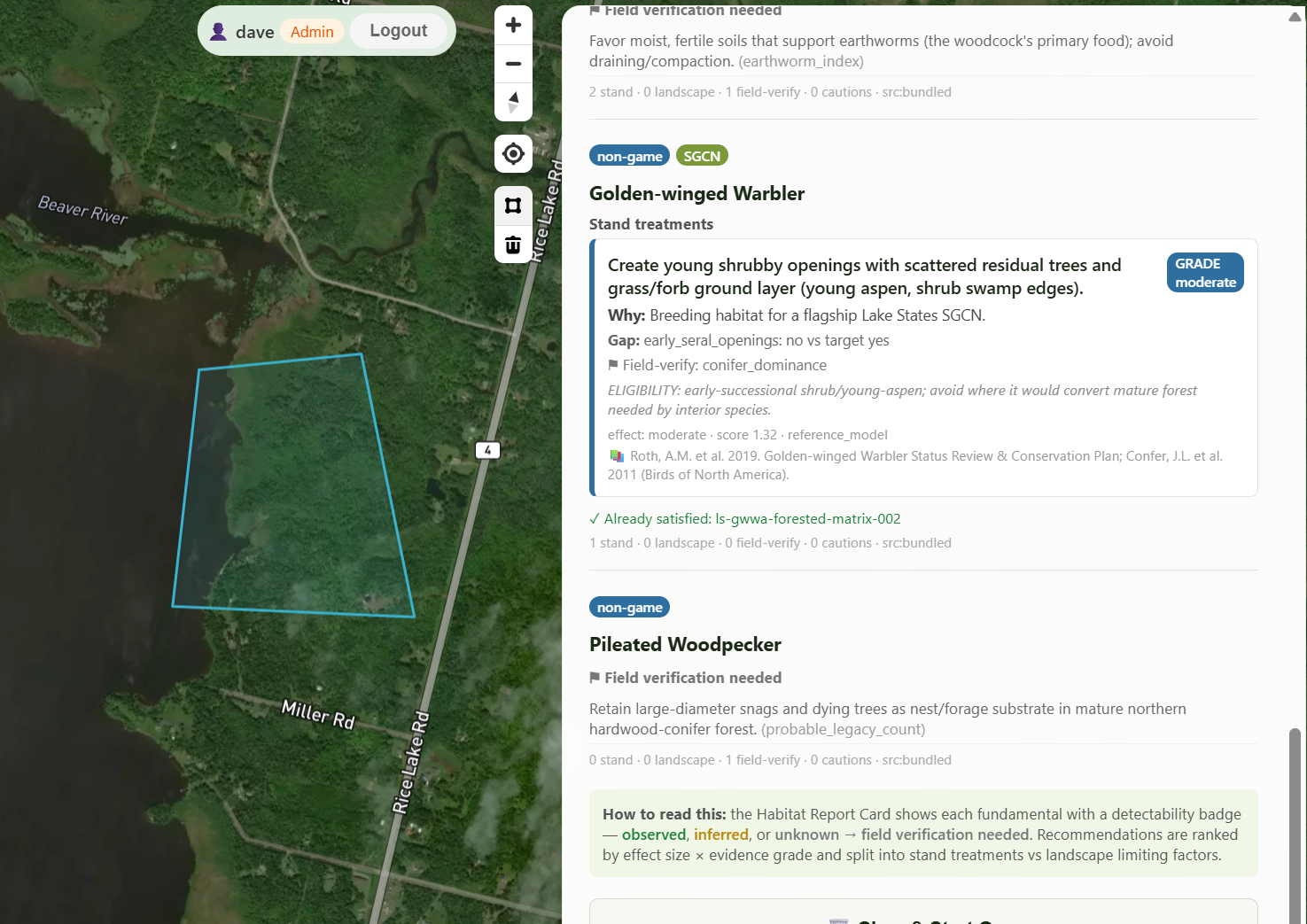
Leopold’s framework is the same thinking I used in creating www.LandPulse.net, a satellite forest intelligence tool that I’m eager to share with the Guild. I’m offering free beta accounts to Guild foresters in hopes that I get feedback to make this tool more useful to our field.
Ask a forester what the job comes down to, and after the caveats fall away you can usually reduce it to a handful of questions. They are deceptively plain. Each one opens onto a literature no single person could hold, but the questions themselves are simple enough to fit on the back of a napkin:
- What do we have?
- What is changing or threatening it?
- What should it look like?
- What do we take, and what do we leave?
- How do we know if we got it?
These are not a checklist to be worked through once and set down. They form a loop. The last question feeds back into the first two, and the cycle begins again—ecological forestry at its core. There is a theme that runs underneath all five, and it is worth naming first, because it is the deepest reason a tool like LandPulse belongs in this discipline at all.
The invisible shapes the visible
"One of the penalties of an ecological education is that one lives alone in a world of wounds. Much of the damage inflicted on land is quite invisible to laymen. An ecologist must either harden his shell and make believe that the consequences of science are none of his business, or he must be the doctor who sees the marks of death in a community that believes itself well and does not want to be told otherwise." — Aldo Leopold, A Sand County Almanac, with Essays on Conservation from Round River (1966)
The damage is there—but it is hardly visible to anyone without the training to read it, and often invisible even to the trained eye at a single moment, because it hides in time and space rather than in plain sight. The pure protectionist does not see it, nor does the short-term industrialist, each arrives with a pre-conceived fixed view of what the land looks like, and thus a reason to stop looking. The question this article asks is a practical extension of Leopold’s: if seeing the invisible is the ecologist's super-power, what could help a forester see more of it, across more ground, over more years, than one person standing in one stand ever could?
A forester standing in the woods sees the visible forest: the stems, the crowns, the spacing, and the light available for regeneration. But not all what determines that forest's fate is available at a single moment. Forces that decide whether a desired future condition is achieved can be invisible because they are the wrong size for a human on periodic site visits to perceive. Some are invisible because they are literally underground: nutrient cycles, seed bank, and the soil moisture that a dry-season canopy is quietly living off. Some are invisible because they are too slow: climate drift measured in decades, the gradual encroachment of conifers into a meadow, the multi-year moisture deficit that precedes any visible mortality. Some are invisible because they are too brief: the disturbance you did not learn about until it was too late to act on. Some are invisible because they are spread across time in a way no visit can capture. Finally, some are invisible because it’s a complex interaction of all of the above.
This is the precise place where remote sensing and an ecological geospatial layer earn their keep. Such tools do not see the invisible directly either. No satellite images a mycorrhizal network or watches climate change happen. What they do is make the invisible legible through its visible signatures, accumulated across time and space. You cannot see the network below the soil, but you might see a stressed canopy signature before it is visible to the human eye or before your next visit to the site. You cannot watch the climate shift, but you can read the decades-long drift in green-up timing, in moisture, in species stress. LandPulse is not a substitute for standing in the woods. But it is a way of taking the spectral pulse of the woods across thousands of acres and forty years at once.
With that theme in hand, the five questions read differently.
As an Forest Stewardship Council (FSC) auditor who has spent twenty-five years walking other people's forests, I have been fortunate to see numerous examples of excellent forestry, much of it aligned with Guild principles — and to see the same challenges surface across very different landscapes. Some of the hardest are multi-faceted: difficulty regenerating desired species, where past practices, deer, climate, and inconsistent seed crops each contribute and none is the whole story. Conifer encroachment altering fire regimes and drawing down western water tables. Changing markets and new pests and pathogens that shift priorities faster than plans can absorb. These challenges arrive at the wrong speed, or the wrong scale, to be caught by someone making a quick site visit on a non-industrial property. The monitoring and knowledge base needed to stay on top of it all dwarfs the available resources — not through carelessness, but because we have been asking one person to hold one landscape across one century in a single head.
Of the five questions, satellite monitoring helps least with the two that turn most on a forester’s judgment. What should it look like is and should remain deliberately human — the desired future condition is where the landowner’s objectives and the forester’s ecological judgment live, and no satellite chooses it. What do we take and leave stays the forester’s prescription, though LandPulse can assist through its Silva module, which mines Guild handbooks such as Forestry for the Birds alongside 60,000 USFS Treesearch papers for silvicultural and wildlife recommendations. Where LandPulse earns its keep is at the two questions where occasional boots on the ground are not enough: what is changing, and how do we know if we got it. Near-real-time canopy change detects stressors within two to four weeks of their first appearance as a spectral shift, and emails you the alert. Longer time-series — one to five years — resolve into the signatures of specific problems: conifer defoliators like spruce budworm, oak decline, and oak wilt. Forty years of LandTrendr disturbance history tells you what actually happened to a stand before you inherited it, and forty years of conifer encroachment shows a meadow closing in at a rate no single visit could register. Carbon trajectories, tree height, and approximate basal area — strongest in Region 9 using the FCM 10R9 model — give a defensible starting inventory across ground no one can walk in a season. None of this replaces standing in the woods. It is a way of taking the spectral pulse of thousands of acres across forty years at once, extending perception into exactly the dimensions where the invisible lives.
The shape of the whole
Five questions, forming a loop, and a tool positioned where human cognition and traditional practice are weakest—at the threats that fall out of a busy mind, and at the monitoring that is often opportunistic at best.
Ultimately, Landpulse is an extension of the forester’s perception into time and space, and as a systematic memory for a discipline whose outcomes outlive the people who design them. It is, in the end, an act of respect for how genuinely hard the job is—an acknowledgment that we have been asking the ecological forester to hold a whole landscape across a whole century in a single head, and that the things that get missed are missed not through carelessness but because the ask was never possible in the first place.
LandPulse is a work in progress, and Guild foresters are uniquely qualified to help validate and improve this tool. While I can’t guarantee every algorithm is going to be correct, I’m quite confident it is going to save the overworked ecological forester time, and improve some aspects of their work. If anyone is interested, they can sign up for a free beta account at www.landpulse.net. I would love feedback on what features in data storage, queries, data layers, etc that would make this the satellite tool for ecological foresters.
Recent Posts